Thanks to his experience and strong relationships with local lodge owners, we spent very little time between arriving at a lodge and relaxing after the day’s challenges. Comfortable rooms, well-planned meals, and the chance to rest fully each evening greatly enhanced our enjoyment of the Ghorepani–Ghandruk Trek in Nepal. Dammaru’s careful attention to these details made each day’s end as rewarding as the trekking itself.
Gorja Himal Trekking
Facts of the trip
| Trip Code: | GHT18 |
| Trip Duration: | 26 days |
| Max. Altitude: | 4550m |
| Grade: | Challenging |
| Program Type: | Trekking |
| Trek Start Point: | Birethanti |
| Trek End Point: | Birethanti |
| Accommodation: | Camping |
| Meals: | Breakfast, lunch , Dinner with tea/coffee |
| Mode of Travel: | Adventures |
| Transportation: | Car / Bus / Flight |
| Minimum Pax: | 05 |
| Best season: | March - June / September-November |
Overview: Gorja Himal 25-day trekking
Introduction
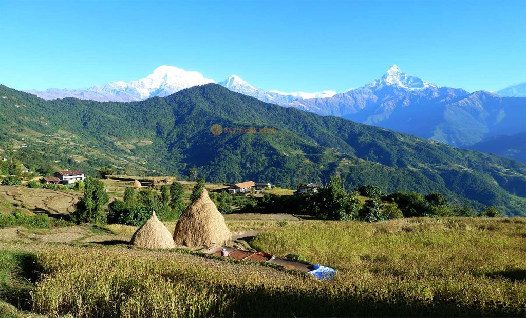
Gorja Himal Trekking is one of Nepal’s least-traveled and most pristine trekking routes, nestled deep within the heart of the remote Dhaulagiri region. Tucked between the more popular Annapurna and Dolpo regions, this off-the-beaten-path journey offers trekkers a rare opportunity to explore unspoiled natural beauty, authentic village life, and sacred mountain landscapes that have remained untouched by commercialization. For adventure seekers looking for solitude, wilderness, and cultural depth, Gorja Himal is a compelling alternative to more mainstream Himalayan treks.
This region’s allure lies in its dramatic mountain views, diverse ecosystems, and the deeply rooted traditions of its indigenous communities. With limited infrastructure and few trekkers on the trail, Gorja Himal offers a true wilderness experience—raw, rugged, and real. From icy passes to lush rhododendron forests, from yak pastures to alpine meadows, and from stone-built villages to ancient monasteries, every element of this trek is rich with stories and scenic grandeur.
About Gorja Himal
Gorja Himal is part of a lesser-known sub-range of the greater Dhaulagiri massif, one of the highest and most formidable mountain groups in Nepal. Unlike the Dhaulagiri Circuit, which draws seasoned mountaineers, the Gorja Himal region remains largely unexplored. Trekkers here pass through elevated ridgelines, isolated valleys, and serene campsites surrounded by glaciers and towering peaks.
The region’s name—Gorja—comes from the local dialect, believed to signify “mystical hill” or “sacred ridge,” pointing to the spiritual significance this mountain holds among local inhabitants. While exact mapping of the trail varies due to its remoteness, typical routes pass through Myagdi and parts of Rukum and Dolpo, depending on the chosen itinerary.
Because of its remote nature, the trek requires a full camping setup, experienced guides, and logistical support. There are no permanent lodges, adding to the sense of adventure and authenticity.
Location and Accessibility
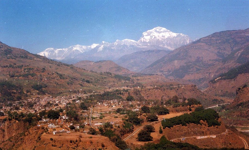
Gorja Himal lies west of the Dhaulagiri Range and east of Dolpo, bordering Myagdi, Baglung, and parts of Rukum District. Access usually begins from Beni or Darbang in Myagdi District, reached via a drive from Pokhara or Kathmandu. The trek then ascends through remote Gurung and Magar villages before entering alpine wilderness areas above 4,000 meters.
Trekkers must cross high ridges, glacial rivers, and forested slopes, with some passes reaching above 4,500 meters. Seasonal snow can make routes impassable in winter, and the best time to trek is from late March to early June or September to mid-November.
Due to its remoteness, trekkers must obtain special permits and travel with licensed guides—something that makes the Gorja Himal Trek even more exclusive and protected.
Lifestyle and Culture:
The cultural richness of the Gorja Himal region is deeply rooted in the traditions of the Magar, Gurung, and Chhetri communities who live in scattered villages at lower elevations. These ethnic groups lead traditional agrarian lifestyles, relying on livestock herding, barley farming, millet cultivation, and seasonal labor migration.
Homes are typically stone-built with slate roofs, surrounded by terraced fields. Hospitality is sincere and warm, though interaction is limited due to the trail’s remoteness. Villagers follow a subsistence lifestyle, cooking over open fires and living off the land.
Cultural expressions are rich in music, festivals, and oral storytelling. The Magar people, in particular, celebrate several local festivals such as Maghe Sankranti, Tihar, and ancestral worship rituals that blend Hindu and shamanic practices.
Traditional dress is still common, especially during festivals or community gatherings. Life here is humble but deeply spiritual, with a close connection to nature and the mountains.
Religious Practices and Beliefs
While the region’s lower villages primarily follow Hinduism, particularly among Chhetris and Brahmins, Bon and Tibetan Buddhism are prevalent in higher altitudes and among the Magar and Gurung populations.
Many local shrines, mani walls, and prayer flags reflect a syncretism of animist beliefs, nature worship, and Buddhist cosmology. Mountains, rivers, and forests are considered sacred, inhabited by deities and spirits. The peaks of Gorja Himal are believed to be the abodes of protective mountain gods, and locals perform offerings before planting, harvesting, or traveling to high-altitude areas.
There are occasional sightings of lamas (monks) who journey from Dolpo or Mustang for ceremonial purposes. Sacred caves and meditation sites are also found deep in the forested areas, used historically by hermits and yogis seeking solitude.
Vegetation and Natural Beauty
The Gorja Himal region encompasses a dramatic range of vegetation zones, from subtropical forests at lower altitudes to alpine tundra and glacial terrain at higher elevations.
Lower Altitudes (1,500–2,500m): Terraced hills with forests of pine, alder, bamboo, and ferns.
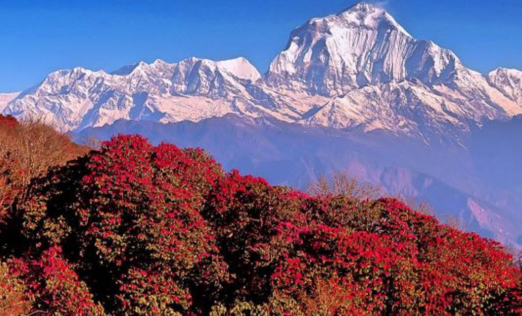
Mid Elevations (2,500–3,500m): Rhododendron, oak, and hemlock forests carpet the hillsides, especially colorful in spring.
High Altitudes (3,500–4,500m): Juniper, birch, and dwarf shrubs give way to grassy meadows and alpine tundra.
Above 4,500m: The landscape becomes barren and rocky, dominated by scree slopes, moraines, and glaciers.
This layered diversity makes the trek a botanical journey. Springtime brings a burst of flowers—rhododendron, primulas, and Himalayan blue poppies. Autumn, on the other hand, reveals golden meadows and snow-dusted passes under clear skies.
Flora and Fauna
Gorja Himal is part of the Dhaulagiri Conservation Landscape, home to a remarkable variety of flora and fauna, much of it endangered or rare. Due to its relative isolation, the ecosystem here remains intact and ecologically significant.
Wildlife Highlights:
Himalayan Thar: Frequently spotted on rocky cliffs and ridgelines. Musk Deer: Elusive and shy, found in higher forested areas. Snow Leopard: Rare and highly secretive, known to inhabit the higher altitudes. Red Panda: Inhabits dense rhododendron forests but is difficult to see. Himalayan Monal (Danphe): Nepal’s national bird, often spotted in the subalpine zones. Langur Monkeys: Seen in the lower temperate forests.
Birdlife is also abundant, with pheasants, cuckoos, and eagles soaring above the valleys. The biodiversity here rivals more famous national parks yet remains largely unstudied due to the area’s remoteness.
Why Choose Gorja Himal Trek?
1. Seclusion and Serenity
Unlike the crowded Annapurna or Everest regions, Gorja Himal offers solitude and unfiltered nature. You can walk for days without seeing another trekking group.
2. Untouched Culture
This is one of the last places in Nepal where you can witness pure, unadulterated village life—free from modern distractions. Every interaction feels authentic.
3. Dramatic Landscapes
From glacier-fed rivers and high passes to lush forests and sacred peaks, the scenery is breathtaking and ever-changing. Perfect for seasoned trekkers and nature lovers.
4. Physical and Mental Challenge
Due to the lack of teahouse infrastructure, this is a fully camping trek. It provides a sense of achievement, endurance, and connection to the environment.
5. Spiritual Depth
The religious significance of the landscape, prayer flags fluttering in the wind, and the presence of ancient shrines lend the trek a quiet, sacred atmosphere.
Nepal Freelance Guide: Your Ideal Trekking Partner
To explore such a remote and complex route, it’s essential to travel with an experienced and locally connected operator. Nepal Freelance Guide is a trusted trekking partner known for leading personalized and safe expeditions across Nepal’s hidden trails—including Gorja Himal.
With over two decades of experience and a network of local guides, cooks, and porters, Nepal Freelance Guide ensures a seamless adventure. Their team prioritizes:
Safety and logistics in remote environments.Sustainable tourism practices to protect the fragile ecosystem.Cultural sensitivity, enabling meaningful interactions with local communities.Tailored itineraries to suit your pace, interests, and preferences.Whether you’re a seasoned trekker or a wilderness enthusiast, Nepal Freelance Guide ensures your Gorja Himal experience is both unforgettable and deeply rewarding.
Conclusion: Trekking into the Heart of Wilderness
The Gorja Himal Trek is not just a journey across mountain trails—it is an immersion into a forgotten Himalayan world. Here, nature speaks loudly in the sound of wind rustling through pine forests, in the roar of glacial rivers, and in the stillness of snowy peaks that touch the sky.
In an age where many treks have become tourist highways, Gorja Himal remains an untouched sanctuary—a realm of ancient traditions, raw nature, and spiritual solitude. It challenges your body, sharpens your mind, and opens your soul.
For trekkers seeking something beyond the ordinary—something wild, authentic, and transcendent—the Gorja Himal Trek is a rare gift. And with the expert guidance of Nepal Freelance Guide, your steps will not only be secure but deeply enriching as you walk through one of the last great wildernesses of Nepal.
Day 01: Arrival at Kathmandu Airport
Day 02: Rest and recuperate.
Day 03: Drive 6 hours to pokhara, or flight for 25 minutes the second beautiful city of
Nepal
Day 04: From here the trail takes to Bhandara Dewrali fir camp in the late afternoon (walking time 6 hours)
Day 05: The route goes downhill in the morning to the village called sallyan.
Day 06: hike along the Kaligandaki River
Day 07: The walk is easy through flatland and rice field to the Dharbang Village
Day 08: Ascend uphill to Dharapani and lunch
Day 09: The trail ascends up through the highland Jungle to Jaljal pass.
Day10: Rest day
Day 11: Hike up to Gorja Base camp along the Gorja river
Day12: climb five or six hours up one of the smaller peaks in the area.
Day 13: Walk down to Gaon where the porters and other group members camp.
Day 14: The groups continues along the Gorja and Chure mountains
Day 15: The route now leads to phupal lake at 16000 ft
Day 16: From Phupal lake walk up to Syangja Khola
Day 17: trips to Jhangla Bhanyang or ups to the Base camp of the churen range.
Day 18: Trek down towards illmar Village and camp about a mile from this settlement.
Day 19: After breakfast the route leads uphill through dense forests
Day 20: In the morning walk uphill for about three hours and cross over the right at phagune Dhuri
Day 21: This day again leads you uphill in the morning up to Godi Khola and Godi Bhanjyang
Day 22: Trek to Okharbot or Meygdi Khola
Day 23: Trek to Kusma
Day 24: Trek to Karkineta
Day 25: Walk to suyangja Naudanda
Day 26: The groups drive to Pokhara
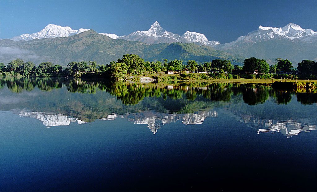
Day 01: Kathmandu to Pokhara (914m): Drive from Kathmandu to Pokhara (914m.) which takes about six hours. You depart early morning at 7 o’clock for the six-hour drive by tourist deluxe bus to Pokhara (915m,), 200 kilometers west of Kathmandu. As you climb out of the Kathmandu valley, only to quickly descend again to the Trisuli River, you follow upstream to its junction with the Marsyangdi River. You follow the Marsyandi gently up through heavily terraced fields and small hill towns to the Seti River that takes you directly into Pokhara. Having pleasant weather, Pokhara is a tourist’s paradise full of natural as well as cultural heritage sites such as lakes, caves, temples of Buddhists and Hindus, andmountains. You can observe views to the north across the hills and Phewa Tal (lake) to the white peaks of the Annapurna and Dhaulagiri ranges. This drive will take most of the morning, leaving much of the afternoon to fall in love with its beauty. You can also fly from Kathmandu to Pokhara, which takes about 25 minutes.
Day 02: Pokhara to Dhampus: After breakfast, drive to Suikhet fedi by private vehicle, about 45-minute from Suikhet fedi start to walk ascending the trial for 2 hrs. Than reach Dhampus and take lunch. From here the trail takes to Bhandara Dewrali fir camp in the late afternoon (walking time: 6 hours)
Day 03: The route goes downhill in the morning to the village called sallyan. We have Lunch here. After lunch, we the trekking trail to the Kodi River called Dobila and then to a place near kusma bazaar for camp (Walking time 7 hours)
Day 04:- After lunch an easy hike along with the Kaligandaki River art a place called Kathe Dobvan. The afternoons walk to Benighat for evening camp. “Ghat” in Nepali means a confluence of Two River. In this case, Benighat is the place where the Kali Gandaki and Myagdi rivers meet. (Walking time 7 hours)
Day 05:- The walk is easy through flatland and rice fields to the Dharbang Village. Lunch will be served at a convenient spot somewhere along the trail. ( Walking tie 7 hours)
Day 06:- Ascend uphill to Dharapani and lunch. In the afternoon we start to hike up to the camping spot. Below the exotic Jungle area called Munasir.
Day 07:- This is probably the hardest day of the trek. The trail ascends up through the highland Jungle to Jaljal pass. We reach Gorja village before so we have Lunch and came to the same place Stay overnight at Gorja village in the ten tent camp.
Day 08: Rest day for Acclimatization After breakfast hike up to Gorja Base camp along the Gorja River and check ours time surrounded the high altitude and enjoy the incredible views and back to the camp side stay overnight the same place.
Day 09:- The groups continue along the Gorja and Chure mountains Lunch will be served at a spot near Doban and the evening camp will be made at Chalika Khola.
Day 10:- The route now leads to phupal Lake at 16000 ft surrounded by the spectacular Dhaulagiri, Gorja and Churen mountain ranges.
Day 11:- From Phupal lake walk up to Syangja Khola at 17000 Ft in the high thin air, so proceed slowly across the alpine tundra.
Day 12:- This is a good day to rest, for those who are really energetic, to organize side trips to Jhangla Bhanyang or ups to the Base camp of the churen range. The area is known for the beautiful hards of mountain sheep.
Day 13: Trek down towards illmar Village and camp about a mile from this settlement.
Day 14:- After breakfast, the route leads uphill through dense forests. Lunch will be made at Kharka Khola. During the afternoon walk to Gustung Kharka and camp in a meadow.
Day 15:- In the morning walk uphill for about three hours and cross over the right at phagune Dhuri ( 14,000 Ft ) After lunch there will be a three hours walk down in Dhorpatan where the group will camp for the Night.
Day 16:- This day again leads you uphill in the morning up to Godi Khola and Godi Bhanjyang. After lunch, the trail descends to Bang Dovan where the group camps.
Day 17:- Trek to Okharbot or Meygdi Khola the lunch stop will be at Tamal Gaon.
Day 18:-Magdi Khola to Kusma In the evening visit with the local Villagers and enjoy their medieval music and culture.
Day 19:- The groups drive to Pokhara by local bus and Fly or Drive back by coach, For rest in a comfortable Hotel.
| Start Date | End Date | Price In US Dollar($) | AVAILABILITY | Booking |
|---|
AVAILABILITY OPTIONS
OPENED: This date is available and open for bookings.LIMITED: There are very limited number of available places on this departure. Immediate booking.
GUARANTEED: We have reached minimum numbers and this trip is guaranteed to depart.
CLOSED: This date is currently unavailable. Please contact us, if you are interested in travelling on this date.
Your Program Duration = 26 days Days
All the Prices are in GBP (£) Per Person.
Cost Include
Cost Is Included
- 2 Night accommodation in Kathmandu with B/B Basie plan
- Kathmandu to Pokhara transfer by bus or Car
- Pokhara to Nayapul transfer by private vehicle
- 1 Night accommodation in Pokhra with B/B basic plan
- All airport and hotel transfers
- National permit & TIMS permit (Trekking Information Management System)
- Accommodation, food and Tea/coffee during the trek
- Guide: including salary, insurance, equipment, flight, food and lodging
- Porter:- including salary, insurance, equipment, food and lodging
- For guest:-Down jacket, Good sleeping bag (down jacket and sleeping bag are to be returned after trip completion)
- All government and local taxes
Cost Exclude
Cost Is Not Included
• Food in Kathmandu Lunch & Dinner)
• Food in Pokhara (Lunch & Dinner)
• Bakery food during the trek. When you eat in the bakery that you need to pay by yourself
• Nepal Visa fee
• International airfare from your country to Kathmandu and from Kathmandu
• Extra night accommodation in Kathmandu
• Travel and rescue insurance if guest get mountain sickness and need to rescue helicopter.
• Personal expenses example (phone calls, laundry service , bar bills, battery recharge, extra porters, bottle or boiled water, shower etc)
• Tips for guide and porters
our testimonials
-
Testimonial from Bell Howse with the Hothouse Group Australia
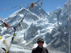
Dammaru Niraula was our guide and confidant for our recent visit to Nepal. We went on a humanitarian visit to build a hothouse in the village of Phortse in the Khumbu region of Nepal but also included some trekking on a personal level before and after our project.…
-
Testimonial Overview: Ian Thwaity, Australia
This testimonial is provided by Ian Thwaity from Australia, who has worked closely with Dammaru Prasad Niraula, a freelance trekking guide and trip leader from Nepal, over a period of three years. Through multiple treks and a…
-
Dear Dammaru I have been trekking to Ghorepani poon hill on Jan 07 for 6 days with Mr. Dammaru. Poonhill is so beautiful, so all I can do is just taking pictures on poon hill. If you were planning to trek in Nepal, I…
-
Overview: Philip Pomeroy Holcot, Northamptonshire, UK.
Introduction: A Memorable Journey to the Annapurna Circuit
In 2004, I was fortunate to join a close-knit group of nine friends from Northamptonshire in the United Kingdom on the Annapurna Circuit Trek in Nepal. Together, we set out on what became one of…
-
Overview: Peter Smith & Jane Fairlie,
South Australia Ghorepani–Ghandruk Trek, Nepal (October 2006)
Introduction:
The
-
Testimonial from Bell Howse with the Hothouse Group Australia
Dammaru Niraula was our guide and confidant for our recent visit to Nepal. We went on a humanitarian visit to build a hothouse in the village of Phortse in the Khumbu region of Nepal but also included some trekking on a personal level before and after our project. Dammaru was a vital link in getting the project off the ground and then as a support person in Nepal before, during, and after. He completed the following tasks with the utmost professionalism and patience. Arranged the transfer of a large number of funds from an Australian bank account to a Nepalese bank account. Communications with the village before we arrived to ensure the walls were built. Organized our itinerary and necessary bookings for the trekking part of our journey for 8 adults. Once we arrived in Nepal, he then assisted us in purchasing all the gear we needed for the finishing of the hothouse. e.g., polycarbonate roof sheeting and the many other bits of hardware necessary. Transport of the roofing, etc., to Phortse village via helicopter, plane, yak, and porter. As well as being a part of the project, Dammaru also was our trekking guide for the duration of our trip of 5 weeks. He organized everything for us from the hotel in Kathmandu and everything in between our trek to base camp. He is honest and reliable and always puts the customer first. I would have no hesitation in recommending Dammaru to anyone who is considering a trip to Nepal.
-
Testimonial Overview: Ian Thwaity, Australia
This testimonial is provided by Ian Thwaity from Australia, who has worked closely with Dammaru Prasad Niraula, a freelance trekking guide and trip leader from Nepal, over a period of three years. Through multiple treks and a major humanitarian project in the Solu Khumbu region, Ian experienced Dammaru’s leadership, professionalism, and personal integrity firsthand.
Long-Term Association with Dammaru Niraula
I have had an association with Dammaru Niraula over the last three years, during which time I completed two significant trekking journeys under his guidance. From the very beginning, it was clear that Dammaru was not only an experienced trekking guide but also someone deeply committed to responsible trekking, safety, and community welfare.
Our relationship developed through shared challenges in remote Himalayan terrain and through collaboration on a long-term community project. Over time, trust and respect naturally grew, based on his consistent performance and genuine character.
First Trek Experience: Gokyo–Phortse–Everest Base Camp
My first trek with Dammaru Niraula was in the Solu Khumbu region, following a thoughtfully designed route through Gokyo, Phortse, and Everest Base Camp. This area is known for its rugged landscapes, traditional Sherpa settlements, and dramatic high-mountain scenery. From the outset, our group requested an itinerary that avoided the main tourist trails wherever possible and included more remote and less-traveled sections of the region.
Dammaru carefully tailored the trek to meet these expectations. His planning reflected a deep understanding of local geography, seasonal weather patterns, altitude considerations, and logistical challenges. The chosen route allowed us to cross quieter trails and experience a more authentic side of the Himalayas, while still reaching iconic destinations such as Gokyo and Everest Base Camp.
Throughout the journey, his knowledge of the region was evident in every decision. The balance between adventure, safety, and cultural exposure was handled with great care. By keeping us away from crowded trekking corridors whenever possible, Dammaru delivered a trekking experience that felt personal, peaceful, and deeply connected to the landscape and communities of the Solu Khumbu.
Knowledge, Planning, and Safety Management
Throughout the first trek, Dammaru’s knowledge of the area was extremely impressive. He was always aware of trail conditions, weather changes, altitude considerations, and potential risks. Safety was never treated casually. It was always his highest priority.
He monitored our health daily, adjusted walking pace when necessary, and made decisions that balanced adventure with responsibility. His calm and confident leadership created a strong sense of trust within the group. At no point did we feel rushed or exposed to unnecessary risk.
Second Trek: A Humanitarian Hothouse Project
The second trek I undertook with Dammaru took place two years later and was far more complex in nature. This journey marked the culmination of a long-term humanitarian project aimed at building hothouses in a village deep in the Solu Khumbu region, specifically in Phortse. The project is associated with www.himalyanhothouse.org.
This trek was not only about reaching a destination. It involved transporting materials, coordinating people, and working closely with a local community to ensure the success of the project.
Pivotal Role in Project Development
Dammaru played a pivotal role in every stage of the hothouse project. He assisted in developing local contacts, sourcing construction materials, and helping to manage project finances. His local knowledge and trusted relationships were essential to moving the project forward.
During the preparation phase, we found Dammaru to be honest, prompt, and extremely hardworking. He understood our goals clearly and showed flexibility and problem-solving skills whenever challenges arose. His commitment to the project went well beyond his duties as a trekking guide.
Coordination and Leadership During the Trek
During the trek itself, Dammaru coordinated seven group members, six porters, and an additional climbing guide. Managing such a team in remote mountain conditions requires strong organizational skills, patience, and clear communication.
He handled logistics smoothly, ensured fair treatment of porters, and maintained group morale throughout the journey. His leadership ensured that both trekking objectives and project responsibilities were completed efficiently and safely.
Interpreter and Community Liaison in Phortse
One of Dammaru’s most valuable contributions was his role as an interpreter and liaison with the people of Phortse village. Communication with local residents was essential for the success of the hothouse project.
Dammaru bridged cultural and language gaps with sensitivity and respect. He ensured that the villagers fully understood the project and that our group respected local customs and traditions. This cooperation created trust and long-term value for the community.
Personal Character and Humanitarian Values
On a personal level, Dammaru is one of the most genuine individuals I have met. He is a man with a big heart and a sincere commitment to helping others. He shared our passion for the hothouse project and fully embraced its humanitarian ideals.
His motivation was not financial or personal recognition. Instead, it was driven by service, responsibility, and care for both clients and local communities. These qualities are rare and deeply admirable.
Consistent Focus on Safety and Care
Once again, throughout the entire trek, our safety was Dammaru’s primary concern. Whether dealing with weather changes, physical fatigue, or logistical challenges, he always placed the well-being of the group first.
This consistent focus on safety, combined with his calm demeanor, created an environment where we could fully trust his decisions and enjoy the experience.
Professional Philosophy: “Service Is Most Important”
A phrase often used by Dammaru perfectly summarizes his professional ethic:
“Service is most important.”This philosophy is reflected in every aspect of his work. From trek planning and execution to community engagement and client care, his actions consistently align with this belief.
Final Recommendation
I would not hesitate to strongly recommend the services of Dammaru Prasad Niraula to anyone planning a trek or similar activity in Nepal. Whether your goal is adventure, exploration, or humanitarian work, Dammaru offers professionalism, integrity, and heartfelt commitment.
Working with him is not just about trekking in the Himalayas. It is about shared values, mutual respect, and meaningful experiences that leave a lasting impact.
-
Dear Dammaru
I have been trekking to Ghorepani poon hill on Jan 07 for 6 days with Mr. Dammaru. Poonhill is so beautiful, so all I can do is just taking pictures on poon hill. If you were planning to trek in Nepal, I would recommend you as one choice. His personality and professional guide skill makes me fun of Trekking and Nepal. so I am planning to go to Nepal again this August. He may meet all demand of you request on your trekking trip even though you join in the big group. Because he has more over 10 years experience of trekking guide for Many English and Japanese speaker. Actually, I have never met such a good Japanese speaker guide and I had no chance to speak in English with him.
I can recommend him to all people who need great experience guide with English or Japanese.
so you can get satisfaction for a great guide.
Very Thanks,
-
Overview: Philip Pomeroy Holcot, Northamptonshire, UK.
Introduction: A Memorable Journey to the Annapurna Circuit
In 2004, I was fortunate to join a close-knit group of nine friends from Northamptonshire in the United Kingdom on the Annapurna Circuit Trek in Nepal. Together, we set out on what became one of the most memorable journeys of our lives. For many of us, this trek was a lifelong ambition rather than a casual holiday. The Annapurna Circuit Trek was already renowned as one of the world’s classic long-distance routes. It was celebrated for its dramatic mountain scenery, rich cultural encounters, and demanding terrain.
Our journey, however, carried added challenges. Most members of our group were approaching, or had already passed, the age of sixty. We knew the trek would test not only our physical strength but also our mental resilience. Adapting to high-altitude conditions would be essential. From the very beginning, we understood that success would depend on expert guidance, careful pacing, and a deep respect for the mountains.
Understanding the Challenge of Age and Altitude
Apart from one younger member, our group consisted mainly of trekkers in their late fifties and sixties. Although we were all reasonably fit and experienced walkers, we never underestimated the challenges ahead, especially the crossing of Thorong La Pass. Thorong La rises to an altitude of 5,416 meters (17,769 feet) and ranks among the highest trekking passes in the world. We understood that altitude sickness can affect anyone, regardless of fitness, and that age can increase vulnerability if proper acclimatization does not take place. Long before we arrived in Nepal, we discussed these risks openly and prepared ourselves mentally for the possibility that not everyone might be able to complete the trek. This awareness made us especially conscious of the importance of choosing the right leader—someone with both technical knowledge and genuine concern for the wellbeing of every group member.Leadership Under Dammaru Niraula
Our group was led by Dammaru Niraula, a name that has remained deeply etched in our memories ever since. From our first meeting with him, it was clear that he possessed qualities far beyond basic guiding skills. He carried himself with quiet confidence, never seeking attention yet commanding respect through his calm presence and thoughtful approach. Dammaru did not treat us as clients on a fixed schedule; instead, he regarded us as individuals, each with different strengths, limitations, and expectations. His leadership style was reassuring rather than authoritative, which immediately put us at ease. For a group of older trekkers stepping into an unfamiliar environment, this sense of trust was invaluable.Gentle Introduction to Lower Altitudes
One of the most impressive aspects of Dammaru’s leadership was the way he introduced us gradually to trekking in the Himalayas. The early stages of the Annapurna Circuit were approached with deliberate care. Rather than pushing us hard from the outset, he allowed our bodies time to adapt to the increasing altitude and daily walking routines. Distances were manageable, rest breaks were well timed, and overnight stops were chosen thoughtfully. Dammaru constantly observed how each member of the group was coping, adjusting the pace when necessary and offering quiet encouragement when fatigue began to show. This gentle introduction built both physical strength and group confidence, laying a strong foundation for the more demanding days ahead.Progression to Longer and More Arduous Days
As the trek progressed and our confidence grew, Dammaru gradually encouraged us to take on longer and more challenging days. This progression felt natural rather than forced. By the time the terrain became steeper and the air thinner, we were better prepared both physically and mentally. Dammaru had an exceptional ability to judge when to push gently and when to hold back. He never allowed competitiveness or pride to override common sense. Instead, he emphasized steady progress, proper hydration, and attentive listening to one’s own body. This balanced approach ensured that even the more demanding stages of the trek felt achievable rather than overwhelming.Acclimatization at Manang
Our stay in Manang proved to be a pivotal moment in the success of the entire trek. Recognizing the importance of acclimatization before attempting Thorong La, Dammaru strongly encouraged us to spend an extra day there. Rather than resting passively, he organized a day hike up the lower slopes of Gangapurna and Annapurna III. This acclimatization walk allowed our bodies to adjust gradually to higher elevations while still returning to a lower altitude for the night. The views were breathtaking, but more importantly, the hike played a crucial role in preparing us safely for what lay ahead.Altitude Safety Awareness
Following the acclimatization hike in Manang, Dammaru encouraged us to attend an altitude safety lecture. This session was both informative and reassuring. We learned to recognize the early signs of altitude sickness, understood the importance of reporting symptoms honestly, and gained clarity on why gradual ascent was essential. Dammaru reinforced these lessons throughout the trek, regularly checking in with each of us and never dismissing even minor concerns. His commitment to altitude safety was unwavering, and it became increasingly clear that our well-being was always his highest priority.Successfully Crossing Thorong La
As we approached Thorong La, the significance of Dammaru’s careful planning became fully apparent. The pass was demanding, both physically and mentally, but thanks to proper acclimatization and steady pacing, every member of our group was able to cross successfully. We knew that altitude sickness forces many trekkers to turn back or descend. Without Dammaru’s attentive guidance, we believe some of us might have faced the same outcome. Standing on the summit of Thorong La marked a moment of profound achievement. Expert leadership and genuine care made that success possible.Gratitude to Dammaru and His Sherpa Team
We remain eternally grateful to Dammaru and his team of Sherpas, whose quiet efficiency and constant support played an essential role in our success. Their teamwork, professionalism, and warmth created a positive atmosphere throughout the trek. Like many Nepalese, Dammaru possesses a gentle and respectful nature, combined with a subtle but delightful sense of humor. His ability to lift spirits during difficult moments added an invaluable human touch to the journey.Personal Qualities and Professional Excellence
At first, Dammaru may seem shy and reserved. This impression soon fades as you see how carefully he looks after his guests. He has a remarkable ability to judge individual temperaments and physical limits. When needed, he adjusts the itinerary smoothly and without drawing attention to the change. After only a few days under his guidance, it becomes clear that you are in the care of an experienced and highly capable mountain professional. His strength lies not only in his deep knowledge of the terrain, but also in his empathy and patience.Final Recommendation
I cannot recommend Dammaru Niraula highly enough. Our experience on the Annapurna Circuit was greatly enriched by his leadership. Our safe and successful crossing of Thorong La stands as a clear testament to his expertise. I am confident he will continue to provide outstanding trekking services in the Himalayas for many years. For anyone seeking a guide who combines professionalism, safety, compassion, and deep local knowledge, Dammaru Niraula represents the very best of Nepal’s mountain guiding tradition.
-
Overview: Peter Smith & Jane Fairlie,
South Australia Ghorepani–Ghandruk Trek, Nepal (October 2006)
Introduction:
The Ghorepani–Ghandruk Trek, Nepal, was the journey we had dreamed of for our first visit to the Himalayas in October 2006. From the very beginning, we wanted to experience Nepal in a personal and meaningful way, avoiding large tour groups and opting for a customized trekking adventure. We were eager to connect with the landscape, explore traditional villages, and meet local communities along the way. After careful research online and speaking with previous trekkers, the Ghorepani–Ghandruk Trek, Nepal, stood out for its stunning mountain views, rich cultural experiences, and a thoughtfully paced itinerary perfect for first-time trekkers.
Choosing a Customized Trekking Company
Before leaving, we spent weeks researching trekking options online, reading reviews, and speaking with travelers who had completed the Ghorepani–Ghandruk Trek, Nepal. We sought a company that specialized in personalized tours rather than mass-group treks. This led us to Himalayan Holidays, based in Kathmandu. Their reputation for organizing tailored experiences reassured us that the Ghorepani–Ghandruk Trek, Nepal, would meet our expectations and provide a memorable adventure.
Physical Preparation and Fitness Concerns
Living in a flat region meant that preparing for the Ghorepani–Ghandruk Trek, Nepal, was a real challenge. We improvised by walking up and down a 700-meter hill on weekends, hoping it would prepare us for the trek’s climbs. Even with this preparation, we were anxious about altitude, long walking days, and our endurance for the Ghorepani–Ghandruk Trek, Nepal.
Meeting Our Guide: Dammaru Niraula
Upon arrival in Kathmandu, we met our guide, Dammaru Niraula. From the first meeting, our concerns melted away. Dammaru’s calm confidence and deep knowledge made us feel secure about our upcoming adventure. He listened carefully to our worries and reassured us that the Ghorepani–Ghandruk Trek, Nepal could be adjusted to match our fitness levels. His focus on safety, comfort, and enjoyment ensured that every day of the Ghorepani–Ghandruk Trek, Nepal, was a perfect blend of adventure, culture, and relaxation.
Managing the Trekking Pace with Care
Once the trek began, Dammaru demonstrated exceptional skill in managing the daily walking pace. Without being overly noticeable, he carefully controlled the tempo so that the enjoyment factor always exceeded any physical discomfort. Rest stops were well timed, days were sensibly planned, and the overall rhythm of the Ghorepani–Ghandruk Trek, Nepal, felt natural rather than forced. We never felt rushed, pressured, or exhausted beyond our comfort level. This thoughtful pacing allowed us to fully appreciate the stunning scenery along the Ghorepani–Ghandruk trails.
Genuine Connection with Local Communities
One of the most memorable aspects of trekking with Dammaru was his genuine relationship with local people. His interactions with villagers, lodge owners, and tea house staff were warm, respectful, and authentic. Because of this, we never felt like intruders along the Ghorepani–Ghandruk Trek, Nepal. We felt welcomed and at ease wherever we went, and these interactions enriched our experience, giving us a deeper understanding of daily life along the trek.
Tea House Arrangements and Comfort
After a long day on the trail, the ability to rest and recover quickly becomes essential. Throughout the Annapurna Circuit Trek, Dammaru’s strong relationships and negotiation skills with local teahouse owners made a noticeable difference. Upon arrival each afternoon, our accommodation was already arranged, clean, and appropriate for our group’s age and comfort requirements. This efficiency removed unnecessary stress and allowed us to settle in without delay.
Rooms were chosen with care, often positioned away from noise and cold drafts, ensuring better sleep at altitude. Dammaru also paid close attention to dining arrangements, encouraging warm, nourishing meals and adequate hydration. His calm presence and thoughtful planning created a sense of security at the end of each day. These seemingly small details greatly enhanced our overall trekking experience. They allowed us to conserve energy, recover properly, and face the following day’s walk with renewed confidence and enthusiasm.
Efficient Organization and Meals
Professionalism and Knowledge Throughout the Trek
Dammaru’s professionalism was faultless from start to finish. Throughout the trek, he shared a wealth of information about Nepal’s history, culture, flora, and fauna. His explanations helped us understand not only the landscape but also the traditions and daily lives of the people along the Ghorepani–Ghandruk Trek, Nepal. This knowledge transformed the trek from a simple walking holiday into an educational and culturally rich experience.
Personality, Humor, and Companionship
Beyond his guiding skills, Dammaru was a delightful traveling companion. His cheeky grin and sense of humor brought lightness and laughter to each day, even during challenging moments on the trail. He balanced professionalism with friendliness perfectly. Conversations flowed easily, laughter was frequent, and his presence made the Ghorepani–Ghandruk Trek, Nepal, feel relaxed, enjoyable, and memorable.
Overall Experience and Lasting Impression Our dealings with Dammaru exceeded all expectations. Every concern we had before arriving in Nepal was addressed with patience, skill, and genuine care. We felt safe, supported, and well looked after throughout the entire Ghorepani–Ghandruk trek. The experience was challenging in a rewarding way and deeply enriching on both a personal and cultural level. Nepal left a lasting impression on us, not only because of its natural beauty but also because of the way we were guided through it.Final Reflections and Recommendation
The Ghorepani–Ghandruk Trek, Nepal, gave us an unforgettable introduction to the Himalayas and the rich culture of Nepal. From breathtaking mountain views to charming villages along the trail, every moment of the trek felt enriched by our guide’s expertise and care. Dammaru Niraula’s professionalism and attention to detail stood out throughout the journey. His friendly guidance ensured that our trek through Nepal’s Ghorepani–Ghandruk region remained safe and enjoyable.
He carefully managed the walking pace and arranged accommodations efficiently. He also helped us connect genuinely with local communities. These efforts made the Ghorepani–Ghandruk Trek in Nepal smooth, memorable, and deeply rewarding. Nepal’s natural beauty only enhanced the experience.
Nepal’s beauty is undeniable, but traveling with the right guide transforms the journey into something extraordinary. We left with lasting memories, new friendships, and a profound appreciation for the Himalayas. We would wholeheartedly recommend Dammaru Niraula to anyone planning the Ghorepani–Ghandruk Trek, Nepal, confident that he will make their adventure just as remarkable as ours.
Recent News and events
-
NEWS & EVENTS Rasuwagadhi Border Closed for Kailash Tour Due to Heavy Rain—Transportation Now Diverted via… Aug-7-2025
© 2026 Nepal Freelance guide | All rights reserved Website by: BESTNEPAL